
ROGUE RIVER 4 DAY RAFTING/CAMPING CRAFT BEER TRIP
Enjoy two of Oregon's best exports river rafting and craft beer with Oregon River Experiences along with Lompoc Brewing for a 4-day trip down the beautiful Wild & Scenic Rogue River in Southern Oregon.
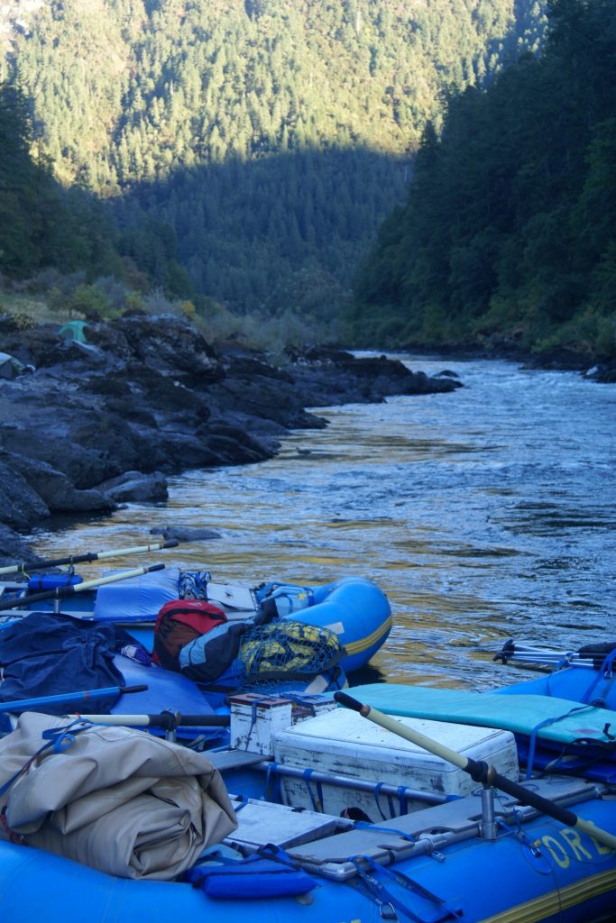
Each day you float downriver in rafts and inflatable kayaks 6-12 miles, splashing and laughing your way through the many rapids of the Rogue. During the day learn about the historic river while keeping an eye out for black bear, bald eagles and river otters. Enjoy delicious riverside lunches during the day and arrive in one of the breath taking riverside campsites.
Afternoons in camp brings options to hike, swim, relax or play a game of bocce ball. Come evening time sit down for appetizers and learn about Lompoc's brewers selection for the evening, while sipping out of your new ORE river pint glass.
Enjoy the specially designed menu made to highlight the brewers selection and enjoy delicious desserts as the sunsets over the canyon and the stars come out to shine above the river.
Trip Highlights
- Our most popular multi-day trip. A world class river journey!
- Fun whitewater.
- Excellent forest and canyon scenery.
- A great river for viewing wildlife.
- Very good for swimming: warmer water than most Oregon rivers.
- Beautiful beaches.
- Lots of hiking opportunities.
- Interesting historic sites.
- Near Crater Lake & Redwood National Parks as well as Ashland's Shakespeare Festival.
Trip Summary
- Near: Grants Pass
- Trip Length: 3, 4 & 5 days
- Meeting Time: 8:30 AM
- Season: May 1- October 1
- Boat Options: paddle raft, oar raft, row-yourself cataraft, inflatable kayak, stand up paddle board
- Whitewater Rating: III+ (Intermediate)
- Recommended minimum age: 7 or older
Trip Guides:
The Rogue River is a classic multiday river trip and craft beer is a Oregon classic, we think it only makes sense that they go together. Join O.R.E. and Lompoc Brewing as we take a slight twist on the regular O.R.E. river trip, by bringing the head brewer from Lompoc Brewing some of their tasty brews and a specialty designed menu specific for that trip's beer offerings.
A Rogue river rafting trip is one of America's premier river journeys:
- The Rogue is a strikingly beautiful stream that cascades through a exquisite canyon mantled in Douglas fir, western hemlock, oak and madrone.
- Fern grottoes, beautiful sandy beaches, sparkling waterfalls, lovely side streams, translucent swimming holes, historic homesteads, and exquisitely carved rocks combine to create a place that's pure magic.
- The Rogue River canyon is home to black bear and raccoons, to river otter, deer and mink, to salmon and trout, and to osprey, blue heron and bald eagles. It's wild country and wildlife is everywhere: perhaps more wildlife than you're likely to see from the water anywhere in the USA outside of Alaska.
- The rapids are equally wild: from boulder gardens and narrow chutes to long wave trains and turbulent currents beneath spectacular canyon walls. We encounter numerous challenging but forgiving class III rapids on our journey, including Tyee, Wildcat, Black Bar Falls, Horseshoe Bend, and Devil's Staircase. Two spectacular class IV rapids — Mule Creek Canyon and Blossom Bar — are trip highlights.
- The rapids are great fun, but there's more here as well. Time and conditions permitting we stop to explore the swimming holes at Howard Creek, Mule Creek or Big Windy Creek, pay a visit to an historic ranch or a gold-rush era cabin, or stop for a picnic lunch at the waterfalls and jumping rocks at beautiful Flora Dell creek.
2018 Dates: 6/29/18, 8/5/18
Price: $1175 per adult*
*Must be over 21 to attend trip
First Morning
We meet at 8:30 AM on the day your trip begins at the Galice Resort Cafe. The Resort is situated along the banks of the river not far from the town of Grants Pass. Galice is roughly 400 miles north of San Francisco, California, and 250 miles south of Portland, Oregon. (Please have your breakfast before our meeting time, and arrive Rogue river morning in your river clothes.) Our Lead Guide will meet you in front of the cafe and store. Look for a vehicle sporting the O.R.E. logo. If in doubt about where to find us, ask a Galice employee at the store, and they will assist you. After a brief orientation you will pack your things into our river bags, and park your vehicles at Galice. We will then go by van to the launch site a few miles downstream. Depending upon trip length and water level, we begin our river trip at either Almeda Bar, Argo Bar, or Grave Creek boat ramp.
Once we arrive at our launch site, you’ll meet the rest of our guide crew, and they’ll conduct a short safety and orientation briefing, which will include instruction on paddle and rowing techniques as needed. We’re normally on our way downstream by mid-morning.
On the River
Each day is a bit different. But a typical day on the river begins with freshly brewed coffee around 7 AM, and breakfast by 8 AM. After breakfast we’ll pack our bags and load the boats. Then, after a brief orientation to the day’s adventures, we’ll head downstream.
We’re on the river an average of four hours per day. Along the way we stop for a riverside picnic lunch. We may also stop to swim, to explore historic sites, to scout rapids, or hike up scenic side streams. We usually arrive at camp by mid to late afternoon, and while the guides or prepare hors d’oeuvres and dinner, you’ll have time to hike, swim, fish, read, or nap and sample the evenings featured beer.
Last Day
We typically arrive at Foster Bar, our take-out point, between 1:30 and 3 PM. Once we’ve unpacked, you’ll board a van for the ride back to Galice. (On small trips, we will completely de-rig the boats, and our guides will accompany you back to Galice. On larger trips, you will say good-bye to the guides when you leave Foster Bar, as they will stay behind to finish de-rigging.) The ride takes about two hours, on scenic Bear Camp Road through the Siskiyou National Forest. Climbing 4,000 feet through mountainous terrain before descending to Galice, it’s a beautiful drive. (It is also a winding road, so if you’re particularly susceptible to car sickness you may want to bring Dramamine.) We arrive back in Galice between 4:30 and 6:00 PM.
- The services of our professional guides and staff.
- Transportation to our launch point from Galice, and from our take-out back to Galice at trip’s end.
- All meals, from lunch on the first day through lunch on the last. Our specially paired menu for the featured beers of the trip are delicious, fresh and hearty. Meals are prepared in riverside by our guides from the highest quality ingredients. Juice and water are available at each meal. Coffee, tea, and cocoa are available at dinner and breakfast.
- Take home O.R.E. Metal Pint Cup along with the evenings featured beer for appetizers and dinner.
- Special dietary needs may be accommodated with advance notice. We provide cups, plates, and silverware and etc.
- Durable, professional quality rafts and river running equipment, including U.S. Coast Guard Approved lifejackets.
- Waterproof river bags and boxes for your personal gear.
- Tent, sleeping bag, sleeping bag liner, sleeping pad, camp chair.
We meet at 8:30 AM on the day your trip begins, at the Galice Resort Cafe. To get to Galice, take Interstate 5 to the Merlin exit (exit # 61), five miles north of Grants Pass, then follow the signs to Merlin. This will put you on the main road, which passes through Merlin and continues to Galice, about 15 miles west of I-5. The Galice Resort is on the right-hand side, between the road and the river. There’s no “Galice Resort” sign – look for the café. The address is 11744 Galice Rd, Merlin, OR 97532. Galice is roughly a 40 minute drive from Grants Pass.
The closest commercial airport is Medford, Oregon. It is served by Alaska, United, Delta, and Allegiant airlines. Plan your flight to arrive the day before your river trip begins.
Car rentals are available at Medford. Also, the Galice Resort offers shuttle service from the airport to Grants Pass or to the resort (which is our meeting place). Shuttles are $525 round trip, per van, so your ultimate cost depends on the number of people (1 to 14) who share the ride. For more information or reservations contact the Galice Resort at 541-476-3818 or visit www.galice.com.
Your trip fare includes transportation from Galice to our put-in point, and from our take-out point back to Galice at trip’s end. If you’re planning to drive up or down the Coast after your river trip, you may wish to leave directly from takeout. When we meet in Galice on put-in day, your guides can assist you in arranging to have your car shuttled to takeout. Galice Resort conducts these shuttles, at a cost of approximately $115 per vehicle.
You will need to bring your own clothing and toiletries. You will also need to bring a tent, sleeping bag and sleeping pad, although if you prefer you can rent them from us instead. (Info here.)
Details, tips, and a complete list of what to bring are found here. You will receive a copy of this information when you sign up for your trip.
Fishing on the Rogue is fair to good during spring and summer and good to excellent in the fall. If you would like to fish you will need an Oregon fishing license, which may be purchased at Oregon sporting goods stores, at the Galice Resort, or online at the Oregon Department of Fish and Wildlife's web site.
We select beautiful beaches, meadows, and forest glens for our camp sites. Our guides establish a central kitchen and social area, and trip members select spots in the surrounding area to pitch a tent or roll out a sleeping bag.
Most camps are equipped with outhouses, while at other camps O.R.E. will set up a portable toilets.
O.R.E. practices minimum impact camping, and the crew will instruct you on the simple steps we follow to protect the river.
The river we now call the Rogue has been known by a variety of names over the years. Trappers called it Tutuni, with various spellings, meaning rogue or rascal Indians. For the same reason, French trappers called it La Riviere aux Coquins, the River of the Rogues, and Henry Eld of the Wilkes Expedition in 1841 wrote in his journal about the Rascally River. The river was also known for a short time as McLeod’s River, after an early explorer, and by the Territorial Legislature as Gold River.
Tribes speaking two different languages occupied the Rogue River valley and surrounding area. Prior to the arrival of the Europeans. The Tutuni lived along the coast, at the mouth of the river and for a distance upstream. In 1854 the Tutuni population was estimated at 1,311 people; 383 remained in 1910. The Takelma tribe lived along middle sections of the Rogue, as well as along the Illinois River, a tributary of the Rogue. (Takelma, by the way, means “those who dwell along the river”.) In 1780 the tribe’s population was estimated at 500; only one person remained in 1910.
The Tutuni lived in large permanent villages made possible by a plentiful, year-round supply of food. They relied heavily on food from the sea, including salmon, shellfish, seaweed, and occasional whale-meat. Deer and elk, as well as berries and seeds were also included in their diet.
The Takelma, on the other hand, were semi-nomadic, and moved from place to place as food supplies became scarce. They relied on deer and other game, berries and root plants for their sustenance.
The Takelma were more aggressive than the Tutuni. The Takelma raided their neighbors to the west for food, other supplies, and slaves. Slaves were, in turn, often traded to the Klamath Indians to the east.
These raids aside, until about 1850 the Rogue River country was a relatively peaceful place. The Takelma’s reputation for aggression, combined with a report by explorer McCloud that described the area as “destitute of beaver” kept the encroaching tide of outsiders at bay. But two events changed this.
One was the 1850 Land Act, which promised 320 acres to each Oregon settler over 18 years of age. (Eventually, 2.5 million acres were given away under the provision of this law.) The other event was the discovery of gold, first on Josephine Creek along the Illinois River in 1850, and then near Jacksonville in 1851.
Soon, settlers and miners were flocking to the Rogue River country. By 1853 most of the rivers and creek beds of southwestern Oregon were being prospected for gold. Signs of this busy period in the Rogue’s history remain at numerous sites along the river today.
Miners and settlers in large numbers cut trees, hunted wildlife, and took over lands that were the homes of the Tutuni and Takelma. Displaced natives resorted to harassing wagon trains and disrupting mining operations in defence. Skirmishes and counterattacks grew into a conflict that came to be known as the Rogue Indian War. This 8 month war began in October of 1855 with the Battle of Hungry Hill, near Grave Creek, and ended the following May with a battle south of Illahe at Big Bend. Most of the war was fought in the remote, winding canyons of the Rogue.
The end result of the conflict, as with similar conflicts elsewhere, was that those Indians who survived were relocated — in this case, to the Grande Ronde and Siletz reservations.
By 1857 no Indians remained in their former homeland. But although there had been a large influx of newcomers earlier in the decade, further settlement occurred slowly, due to the ruggedness of the river canyons.
Flora and Fauna of the Rogue Canyon
The ecosystem of the Klamath Mountains and the Rogue canyon is a complex mosaic of plant communities that provide homes for a wide variety of wildlife. Geologic complexity and a long history of relatively mild climate have created a haven for a diverse mix of plant and animal species, some of which represent prehistoric environments that have long since disappeared elsewhere.
Among the tree species found along the river are California black oak, canyon live oak, Oregon white oak, bay, big leaf maple, madrone, Douglas fir, and red alder. A wide variety of flowering plants bloom in the spring, including azalea, the fragrant white blooms for which the rapid Blossom Bar is named.
An abundance of birds and other wildlife make the Rogue canyon their home. Osprey, bald eagles, hawks, water ouzels, heron, and a variety of songbirds are seen. Raccoons, river otters, deer, mink, black bear, bobcat and other mammals are here, too.
Steelhead, Chinook and Coho salmon either live in the river year-round or migrate up-river to spawn. (Sadly, in recent years their numbers have been decreasing, due to the combined effects of overfishing, damming the river’s upstream reaches, and increased situation due to logging, farming, and urbanization.) Also found in the Rogue are sturgeon, bluegill, smallmouth bass, catfish, sculpin, and shad. Trout are native to the larger tributaries, such as Big Windy, Kelsey, and Missouri Creeks.
Geology of the Rogue River Region
The Rogue River country, which is a part of the larger Klamath Mountain Province, is one of the most structurally complex regions in Oregon. This complexity is due to the region’s position at the edge of the continent, and the role that plate tectonics played in the evolution of the area.
150 million years ago (during the Jurassic period) rocks were being deposited along an ancestral North American coastline. Simultaneously, movement of the Earth’s crust caused the floor of the Pacific ocean to begin to move towards the mainland. The Pacific and North American plates collided. Volcanoes generated by the collision developed into an offshore island chain. As this collision continued, pieces of the sea floor were pushed up against the mainland. The Klamath Mountains are built both of fire and water. Today we see evidence of volcanism, and one can find ancient sea floor, which once was hidden under three miles of water, now perched two to three thousand feet above sea level.
Oregon’s portion of the Klamath Mountains was originally situated 50 miles south of where they are now. About 100 million years ago they broke loose from the mainland along a fault which slowly moved them into their present position. Finally, beginning 50 million years ago, the area was uplifted and distorted, then eroded to create the rugged topography we see today.
Rogue Geology at River Level
In the vicinity of Galice the Galice formation is exposed in the river bed and along the banks. Elsewhere the Galice formation is in excess of 15,000 feet thick, but here we see only a thin slice of that. Rocks of the Galice include mudstones and some black shales. In addition to the mudstones, the Galice bears a thick section of volcanic rocks, some of which, unlike the mudstone and shale, are relatively coarse-grained and very resistant to erosion. In places the Galice mudstones and shales have been altered by heat and pressure to form hard slate.
As the river winds northward out of Galice we very quickly pass from the Galice Formation into the older rocks of the Rogue formation. These rocks originated as submarine lava and ash flows around a chain of volcanic islands. Most of these rocks have been altered by heat and pressure since their formation to create the hard, resistant rocks we see today. Rainie Falls exists because the extra-hard rock found there is resistant to the river’s erosion. Rainie is a good place to view banded metamorphic rock called gneiss, as well as veins of a pale, pea green mineral called epidote.
Landslides are common in the Rogue River canyon. One slide, which occurred near Whiskey Creek in the late 1800’s, dammed the river for a time and backed water 15 miles upstream to Hellgate.
Down river near Tyee Rapid the Rogue formation is replaced by the Dothan formation, which dominates the next 20 miles of river. This formation is composed mostly of sandstone, with some siltstone and mudstone also present. In places along the river these rocks have been warped into tightly bunched folds by the forces that created the Klamath Mountains.
At Horseshoe Bend the river begins a dramatic detour around a hard, quartz-rich wall of rock that temporarily deflects the river from its course.
The change from Dothan back to the Rogue Formation rocks occurs just below China Bar. Less than a mile downstream the river bends sharply to the left and follows an ancient fault line through Mule Creek Canyon. Here Dothan formation rocks comprise the left (east) wall and Rogue formation rocks the right. During the 1964 flood the river level was 80 feet higher here than it is at normal summer flows.
At Blossom Bar, the river’s most legendary rapid, evidence of the power of flowing water is a dramatic sight. The boulders — which create the rapid’s channels, waves and obstacles — were carried down tiny Blossom Bar Creek, from a mile or more upstream, during a flood on that creek.
Below Tate Creek the Rogue formation gives way to the Flournoy formation. These marine rocks are evenly bedded layers of sandstone and siltstone, as well as conglomerates, which create the unusual and striking formations seen near Flora Dell Creek. At 50 million years old this is the youngest geologic formation along the river.
Rustic cabins and a lodge are available at the Galice Resort. Phone 541-476-3818. Also nearby is Morrison’s Lodge (800-826-1963).
Camping is available nearby at Indian Mary Park and also at Almeda Bar Recreation Area, both within 5 miles of Galice. Reservations for both can be made through at www.reserveamerica.com.
While in the area you may want to visit Crater Lake National Park, Oregon Caves National Monument, or the southern Oregon coast. You may also want to visit the nearby towns of Jacksonville and Ashland. Jacksonville, a National Historic Landmark, hosts the Britt Music Festival on weekends in July and August. The Britt Festival features classical, jazz, and bluegrass music under the stars. For information contact the Festival at 800-882-7488. Ashland is site of the renowned Oregon Shakespeare Festival. Because Shakespeare Festival performances often sell out, we recommend that you call well in advance for tickets and information (541-482-4331).
Guests sometimes ask whether it is appropriate to tip their guide. Tipping is optional, but if your guide did a great job then feel free to thank him or her with a gratuity. The amount is up to you, but tips between 8% and 20% of trip cost are customary. Gratuities are customarily presented to the Lead Guide, and will be shared equally among all guides on your trip.