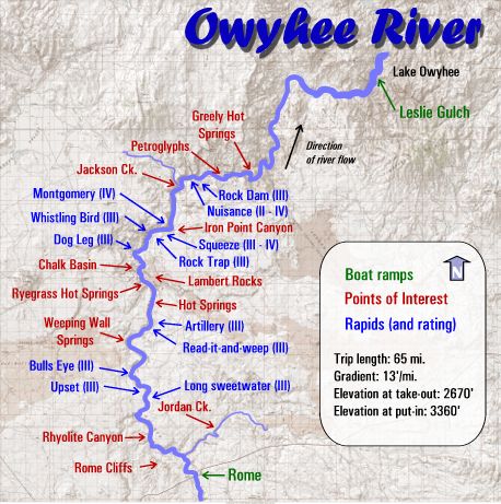
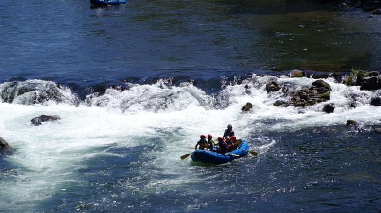
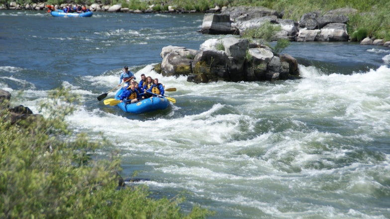
Nestled within the vast expanse of the great American West, the Owyhee River offers a glimpse into the untamed beauty of the region. Surrounded by stunning high desert scenery, this area is steeped in rich history and offers a unique blend of rugged landscapes and cultural heritage. With towns few and far between, the Owyhee River region retains an authentic charm and a sense of wilderness solitude. As a haven for geologists and birdwatchers alike, it promises captivating experiences for those seeking to immerse themselves in nature’s wonders.
Situated over 2 hours away from the nearest major city, meticulous trip planning is crucial for those looking to explore this majestic area. Whether you’re drawn to its geological marvels or the tranquility of its wilderness, the Owyhee River invites you to embark on an unforgettable adventure off the beaten path.
Enjoy the natural beauty and adventure of the Owyhee River region with these outdoor activities:
Explore Leslie Gulch: Venture into the stunning landscapes of Leslie Gulch, where rugged canyons, towering rock formations, and scenic trails await exploration. Whether you’re camping under the stars or hiking picturesque trails, Leslie Gulch offers unforgettable outdoor experiences.
Discover Malheur National Wildlife Refuge: Delve into the rich biodiversity of the Malheur National Wildlife Refuge, a haven for birdwatchers, wildlife enthusiasts, and nature photographers. Embark on guided tours, birding expeditions, or scenic drives to observe diverse wildlife species in their natural habitat.
Drive the Owyhee Uplands Backcountry Byway: Hit the open road and traverse the Owyhee Uplands Backcountry Byway, a scenic route showcasing the region’s rugged beauty, geological wonders, and cultural heritage. Enjoy panoramic vistas, historical landmarks, and opportunities for outdoor recreation along this captivating backcountry route.
Accommodations
For those embarking on an Owyhee River adventure, finding accommodations in the Jordan Valley area is essential. Here are some options to consider:
Basque Station Motel: Conveniently located near our meeting point, Basque Station Motel offers comfortable lodging for travelers seeking a restful stay.
Rome Station: Nestled amidst the picturesque landscapes of Jordan Valley, Rome Station provides rustic accommodations with scenic views.
Crane Hot Springs: Immerse yourself in relaxation at Crane Hot Springs, featuring natural hot springs surrounded by tranquil wilderness.
Restaurants
Exploring local dining options can be a delightful part of your Owyhee River experience. Here are some dining spots to consider:
Rome Station Cafe: Enjoy country-style cuisine and hearty meals at Rome Station’s cozy cafe, offering a taste of rural Oregon charm.
Jordan Valley Cafe: Indulge in homestyle cooking and local favorites at Jordan Valley Cafe, a welcoming spot for hungry travelers seeking comfort food.
Golden Spike Restaurant & Lounge: Located in nearby Vale, Oregon, the Golden Spike Restaurant & Lounge offers a diverse menu featuring classic American dishes and regional specialties.
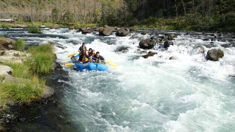
Popular Trips
Great trip for families
Santiam River Rafting – Day Trip
The North Santiam River offers a great introduction to whitewater rafting. Conveniently located near Salem and Portland, it's a great river to raft year round. Our half-day and full-day options include lots of swimming opportunities, crystal clear water and mild, splashy rapids like Spencer's Hole, Carnivore and Mill City Falls. It's a river rafting trip suitable for everyone, whether they be novices or a veteran rafter.
The beautiful McKenzie River is located just East of Eugene and is one of our favorite rafting runs in the Willamette Valley. Swift, crystal clear water moves along a tree-lined river bank and is full of fun Class II+ rapids. With half-day to two-day trips available, there is plenty of great camping, hiking, fishing and whitewater to enjoy.
94
Half & full day
Crystal clear water in the Cascade Mountains of Oregon
The Wild & Scenic Sandy River is an early season delight, as the water generally starts to drop by early June. It courses its way down the slopes of Mt Hood and drops into the Cascade foothills before joining the Columbia River. A great option to see the lesser known portion of this surprising scenic trip that is still close to town.
Oregon's #1 most popular one-day white water rafting trip. The Wild & Scenic Deschutes River rafting trip flows through high desert with consistent and exciting Class III-IV white water rapids. Suitable for beginners, your rafting trip also features world-class fishing and lots of wildlife. This river is only 2 hours from Portland and offers lots of sunshine and swimming even when Western Oregon is cloudy.
The Wild & Scenic Clackamas River is rated as one of the best rafting adventures in Oregon and is only a 45 minute drive from Portland's East side. An unbeatable combination. Three thrilling Class II or Class III+ white water rafting trips are available to choose from. Our half-day trips on the Lower Clackamas are perfect for those new to rafting or with smaller kids. The Upper Clackamas offers a more thrilling rafting adventure. The full-day Upper Clackamas Experience is the most thrilling white water rafting trip we offer. This river has it all.