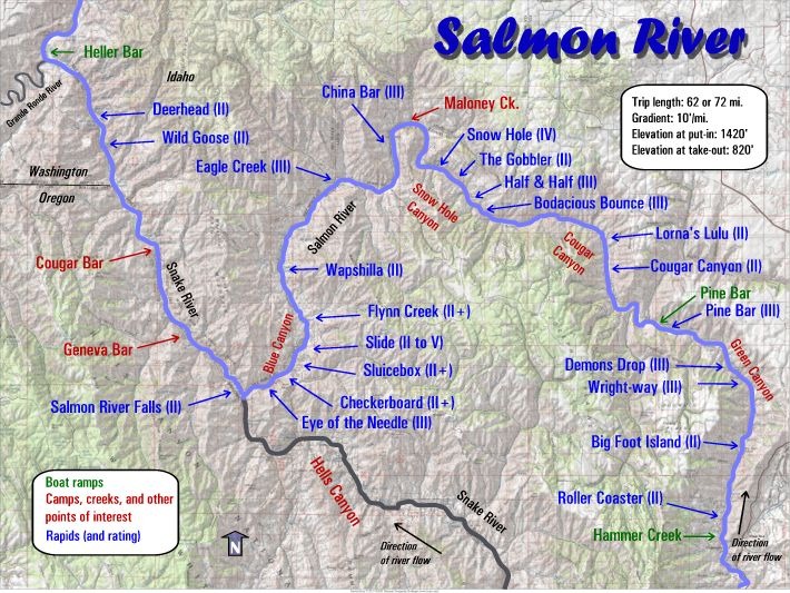
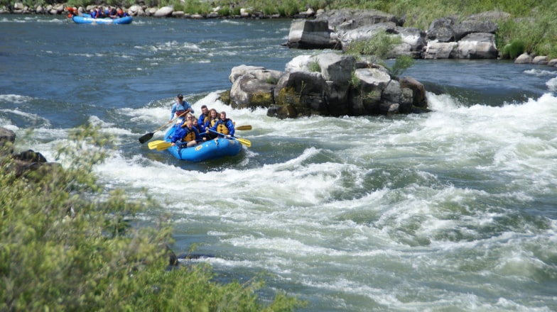
Ready to dive into the natural wonders of the Lower Salmon River? Located in the spectacular depths of Hells Canyon, the deepest river gorge in North America, your adventure begins in Lewiston, Idaho. This historic city, where major rivers meet, has been a pivotal cultural site for over 2,500 years, with a rich history of Native American heritage.
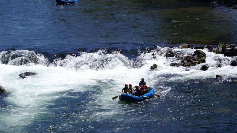
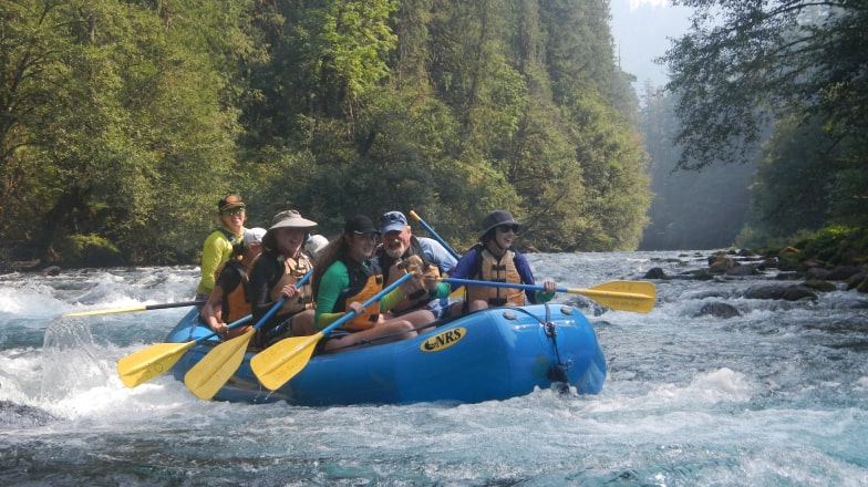
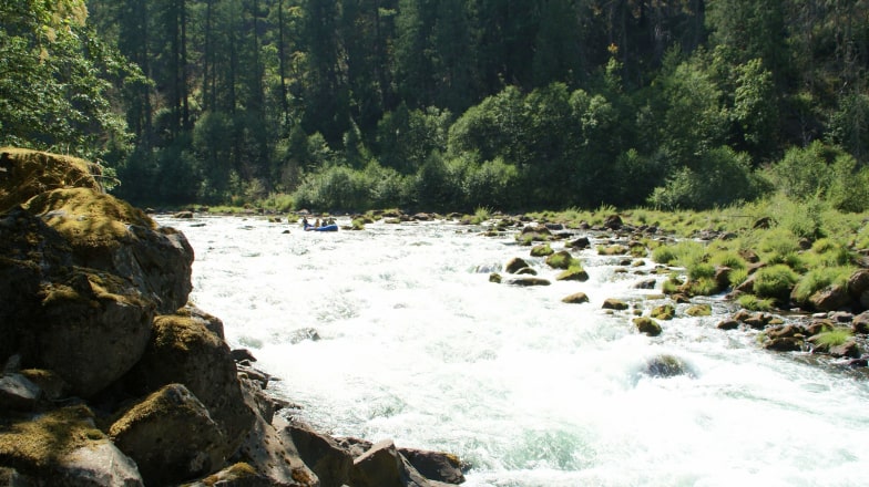
Visitors to this area are drawn to the array of outdoor activities available, from thrilling river rafting to peaceful hikes along the riverbanks. Whether you’re here to test the rapids or soak up the serene landscape, the Lower Salmon River offers a perfect blend of excitement and natural beauty.
Extend your adventure beyond the river with a range of activities that showcase the natural beauty and historical richness of the Lower Salmon River area, such as local museums, hiking scenic trails, or enjoying other outdoor pursuits.
Nez Perce National Historical Park: Dive into the rich history and culture of the Nez Perce people. This park features a variety of sites spread across beautiful landscapes, perfect for educational outings and scenic drives.
Hells Gate State Park: Ideal for families and outdoor enthusiasts, this state park offers boating, fishing, and hiking opportunities, with stunning views of Hells Canyon.
Lewis-Clark Center for Arts & History: Engage with local art and history through the center’s exhibits and events. It’s a cultural hub that provides insights into the region’s artistic landscape.
Accommodations
Discover a variety of accommodations near the Lower Salmon River, perfect for enhancing your rafting adventure. From convenient city hotels in Lewiston and Clarkston to charming riverside lodges along the Snake River, there’s a place for everyone to unwind and recharge.
Hells Canyon Grand Hotel, Lewiston: Conveniently located at our rafting trip meeting point, this hotel provides plush accommodations with modern amenities.
River Dance Lodge, on the Clearwater River: Choose a rustic, luxurious cabin experience in a tranquil setting, ideal for those seeking solitude and natural beauty.
Restaurants
After a day on the river, enjoy a diverse range of dining options in Lewiston and Clarkston, where the culinary scene offers everything from local flavors to international cuisine. Whether you’re craving a hearty meal or a light bite, these cities have something to satisfy every appetite.
Meriwether’s Bistro: Located inside the Hells Canyon Grand Hotel, this bistro serves up American classics with a modern twist, perfect for a relaxing meal in a stylish setting.
Thai Taste Restaurant: For those in the mood for exotic flavors, Thai Taste offers a wide array of authentic Thai dishes, from spicy curries to fresh spring rolls, all made with traditional ingredients.
Tapped Taphouse & Kitchen: A great spot for craft beer enthusiasts and foodies alike, Tapped features a menu of upscale pub fare paired with an impressive selection of local and regional beers.
Popular Trips
Great trip for families
Santiam River Rafting – Day Trip
The North Santiam River offers a great introduction to whitewater rafting. Conveniently located near Salem and Portland, it's a great river to raft year round. Our half-day and full-day options include lots of swimming opportunities, crystal clear water and mild, splashy rapids like Spencer's Hole, Carnivore and Mill City Falls. It's a river rafting trip suitable for everyone, whether they be novices or a veteran rafter.
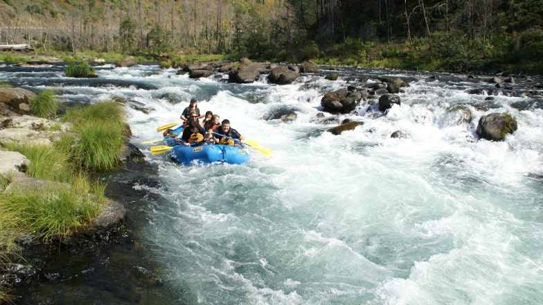
The beautiful McKenzie River is located just East of Eugene and is one of our favorite rafting runs in the Willamette Valley. Swift, crystal clear water moves along a tree-lined river bank and is full of fun Class II+ rapids. With half-day to two-day trips available, there is plenty of great camping, hiking, fishing and whitewater to enjoy.
94
Half & full day
Crystal clear water in the Cascade Mountains of Oregon
The Wild & Scenic Sandy River is an early season delight, as the water generally starts to drop by early June. It courses its way down the slopes of Mt Hood and drops into the Cascade foothills before joining the Columbia River. A great option to see the lesser known portion of this surprising scenic trip that is still close to town.
Oregon's #1 most popular one-day white water rafting trip. The Wild & Scenic Deschutes River rafting trip flows through high desert with consistent and exciting Class III-IV white water rapids. Suitable for beginners, your rafting trip also features world-class fishing and lots of wildlife. This river is only 2 hours from Portland and offers lots of sunshine and swimming even when Western Oregon is cloudy.
The Wild & Scenic Clackamas River is rated as one of the best rafting adventures in Oregon and is only a 45 minute drive from Portland's East side. An unbeatable combination. Three thrilling Class II or Class III+ white water rafting trips are available to choose from. Our half-day trips on the Lower Clackamas are perfect for those new to rafting or with smaller kids. The Upper Clackamas offers a more thrilling rafting adventure. The full-day Upper Clackamas Experience is the most thrilling white water rafting trip we offer. This river has it all.